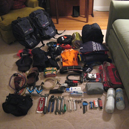
On Saturday, we had a long drive up to Portland, followed by a bunch of beers and a late night. This was perfect preparation for an early morning departure.
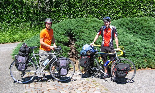
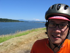
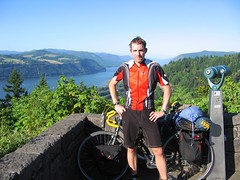
Unfortunately, we probably should have prepared instead of drinking, and slept early instead of waking up late. Here we are ready for our "early" departure at 12:30pm:
The Portland weather was pretty hot - approaching the high 80's when we left. The Hillsdale neighborhood is very hilly, and our first 2 miles were straight downhill on some old and worn streets:
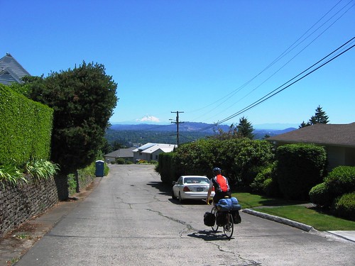
Check out Mount Hood in the distance! What a way to start the tour by exhausting my weak forearms by braking for 20 minutes straight with my newly found extra 40 pounds of weight.
Speaking of the extra weight, I learned my first lesson in loaded touring at the bottom of the hill: ALWAYS gear down (more than you think) when you come to a stop so that you can get going again. The first stop light we came upon, we rolled up without thinking much. When the light turned green, it was so incredibly hard to get going, not to mention just keeping my balance. My shifters are on the handlebars and so I was able to downshift while standing and mashing through the intersection. Seth was less fortunate with downtube shifters, and he managed to barely cross the intersection in one green light cycle!
Lesson learned, and thanks for being patient, Portland drivers! Now I can relate to those crusty tourer dudes in the city who gear down to "circus bear on a unicycle" gearing when they come up to red lights on Valencia Street.
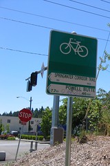
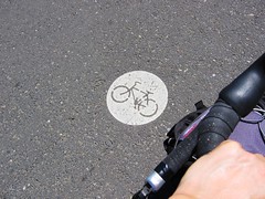
After a harrowing journey over the Willamette River on the Sellwood Bridge, we were able to connect with Portland's awesome multi-use paths. We hopped on the Springwater Corridor Trail:
 | ||
 | 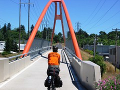 | |
And then to the I-205 bike path, where we encountered some unexpected construction detours:
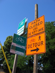
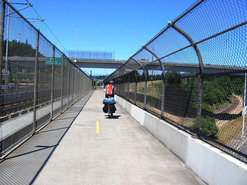
The signage was quite horrible, especially at Stark and Washington Streets, but we eventually found our way. The bike path infrastructure (when not under construction) is really impressive. Here we are along the I-205 bike path passing over various entrance and exit ramps:
It took a while, but we finally made it northward to the Columbia River.
Yup, Mount Hood still far away. Here we turned eastbound along the river and caught a strong tailwind. We averaged about 20 mph on the flat ride to Troutdale. After lamenting the fact that we were stuck in a major rest stop area with only fast food options, we decided to stop at a automobile-choked Flying J. Yummy gatorade and filled up our waterbottles.
Little did we know that just around corner was the cute and pedestrian friendly portion of Troutdale, complete with Mom n' Pop restaurants. Dammit. We biked through without stopping.
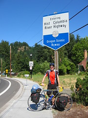
Ok, here was where the "real" riding was to begin. Not that we hadn't been riding for real on the first 30 miles. I was just looking forward to some nice scenery and not having to pull out the map every 10 minutes to make sure we were on track.
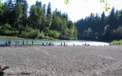
We started the Historic Columbia River Highway by crossing on a bridge over the Sandy River. Today was Sunday, and the river was PACKED with people, kids, families enjoying the water on this 90 degree day. Looked soooooo good. Thankfully, just a couple of miles down the road we found easy river access at the Dabney State Recreation Area. We biked down to the beach and took a dip in the FREEZING cold water.
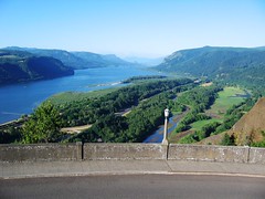
What a way to refresh! Now we had a 6 mile climb up to the Portland Women's Forum Scenic Viewpoint, which is at elevation 850 feet. Not really that high if you think about it; Twin Peaks is about the same elevation. However, 40 pounds of gear made for a pretty tough climb.
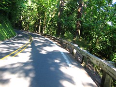
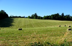
The scenery:
 |  |
 |  |
On the way, we passed a bunch of waterfalls that were literally right off the road (Latourell, Bridal Veil, Wahkeena, Multnoma and Horsetail Falls). Pretty awesome!
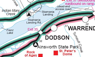
Our destination was Ainsworth State Park. We saw on our wonderful HCRH bikemap that the state park was very very close to a town called Dodson. Doesn't Dodson look like a real town on this map?
The grand plan was to get to the park to set up camp, and head over to Dodson to pick up food and beer. Why unnecessarily carry extra weight while riding? Maybe we could even splurge and have dinner at a restaurant! What a great reward that would be, huh?
When we finally arrived at Ainsworth, our very nice park volunteer informed us that Dodson was nothing more than a couple of residential houses, and without a doubt would NOT have anywhere to buy beer.
Obviously, the no-beer was a problem. But so was the lack of food. After 8 hours of riding, we definitely needed to eat. We almost took the park volunteer's offer of driving us to the nearest town with beer. But instead we let our neighbors shower us with charitable gifts. Boxed mac n' cheese, frozen chicken breast, butter, frozen corn, and some kind of dehydrated bag of potatoes. We ate OK. Much much better than having 2 powerbars for dinner. Showered and slept.
Day 1 stats:
52 miles
Max speed: 31.1 mph on the I-205 bike path
Time on the road: 7 hours 45 minutes